
Who comes up with names like this? Why would you call a perfectly nice mountain, Mt Misery?
There is certainly nothing miserable about Mt Misery, unless you are describing the miserable amount of fitness I possess to complete this hike in anything like a respectable time. This is all about to change as a hike up to Mt Misery is now my Everest Base Camp training route of choice.
Grab your head lamp! We are off on an early morning hike up, up, up in the Aussie bush.

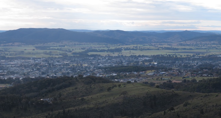
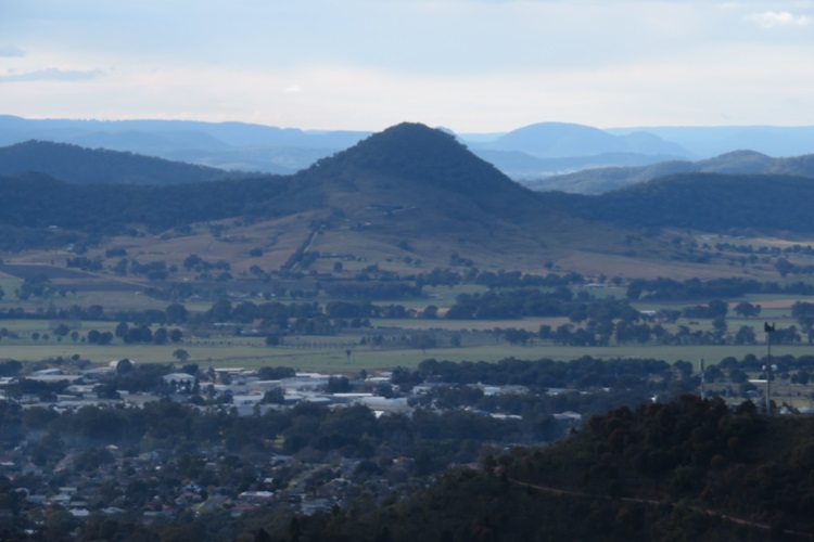
Mt Misery is the backdrop to the small town of Mudgee in Central West NSW. By European and American standards Mt Misery is probably not much of mountain, but we take what we are given in Aus. And harking back to the naming of this mountain, if he (it would definitely be a ‘he’) had the warped imagination to call it a place of misery, it is also a dead cert that he would describe it as a mountain. NB: I did a quick online search and there seem to be endless mountains of misery in Australia. Maybe the early explorers were simply sick of all the ascents?
Here are the Nuts and Bolts of this lofty loop:
- Distance: approx. 10.8km – depending on whose smart watch you believe.
- Time: Dependent on your lung capacity and fitness levels, allow 3-4hours if you include a few rest stops to admire the view.
- Ascent: 524m Descent: 541m
- Rating: Not sure, but I would rate it as moderate-to-hard due to the steepness of some sections and, at times, rough path underfoot.
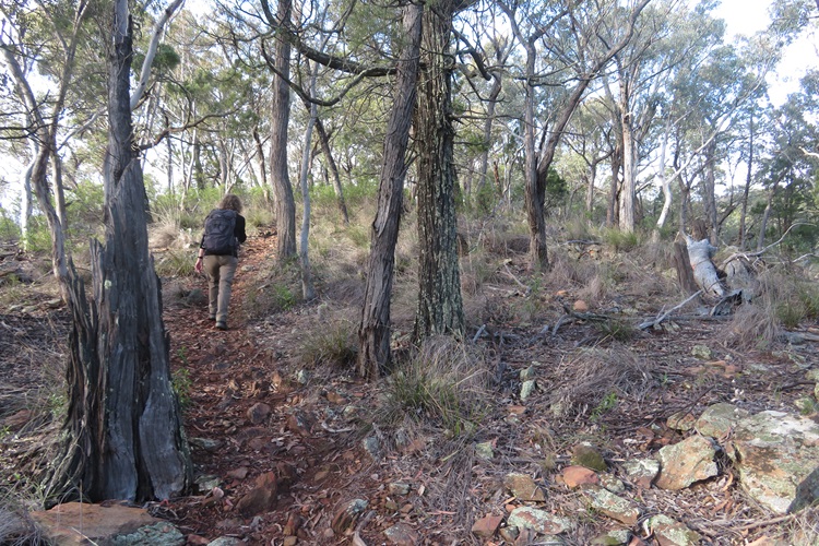
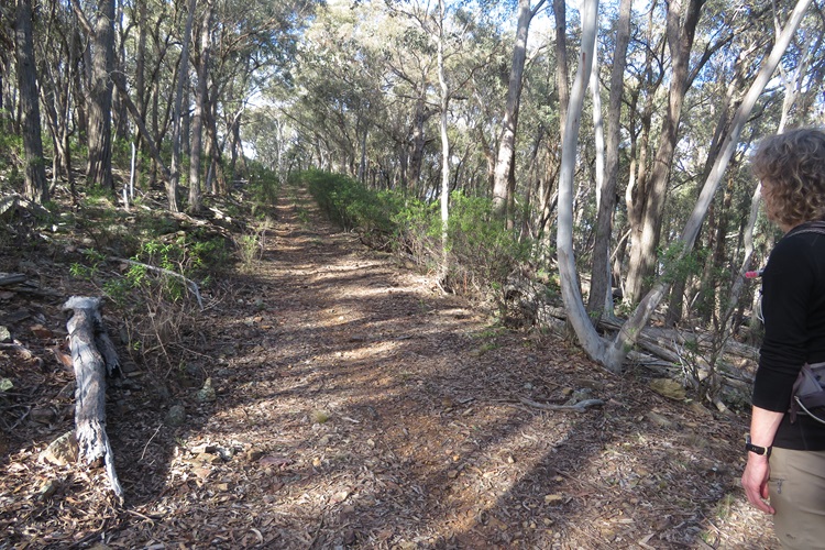
- Terrain: The path is steep whichever direction you walk it – clockwise or anticlockwise. Clockwise you ascend on a wide, graded fire trail (closed to vehicles by a locked gate). Anticlockwise you ascend steeply through rough bush with numerous false summits.
- Path: The track ranges from narrow mountain bike paths, animal tracks, rock hopping/scrabbling over some very steep sections until you reach a wide, clear fire trail which runs along the top of the ridgeline.
- Mobile Phone Coverage: Yes, 100% coverage if you are linked to Telstra.
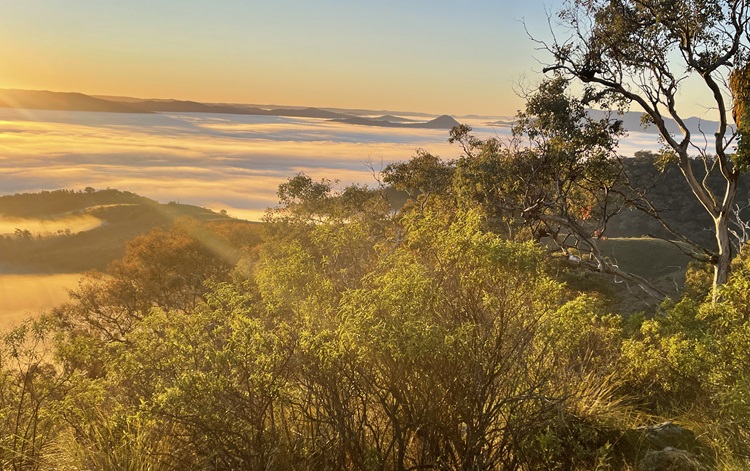
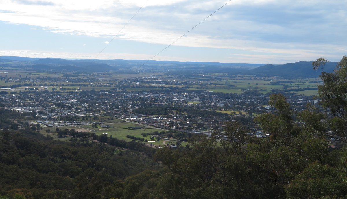
- Facilities: No water, no toilets, nothing but glorious views over Mudgee and beyond. You can really see why the word Mudgee means nest in the hills. Take plenty of water with you.
- Sun Protection: Wear a hat and sunscreen. Even though there is plenty of shade on the path, the Australian sun remains unforgiving.
- Bities: This area is prime snake country in summertime. Be careful where you step. Also take bug spray if you are walking in warmer temperatures.
- Bushfires: Be careful with any cigarettes or naked flame. You are walking in a very inaccessible area and it would be nigh on impossible to make a quick getaway.
General Comments:
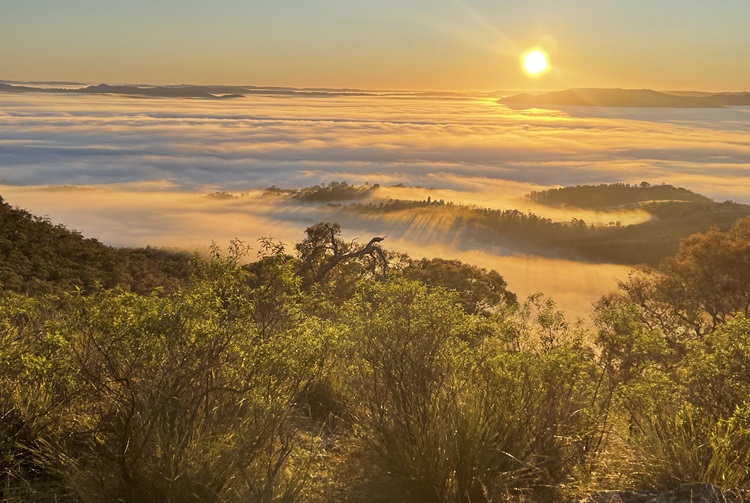
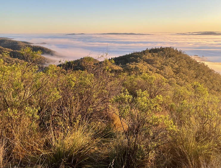
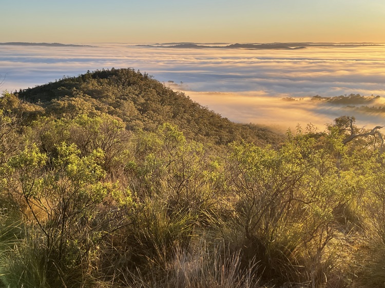
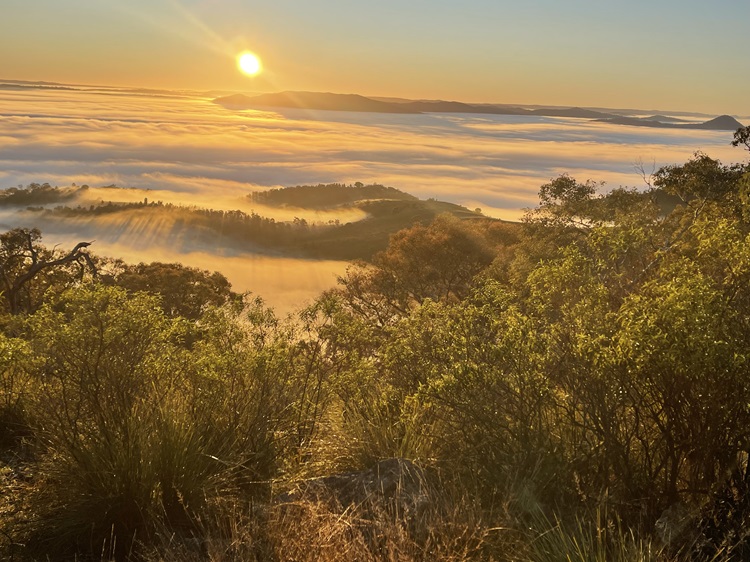
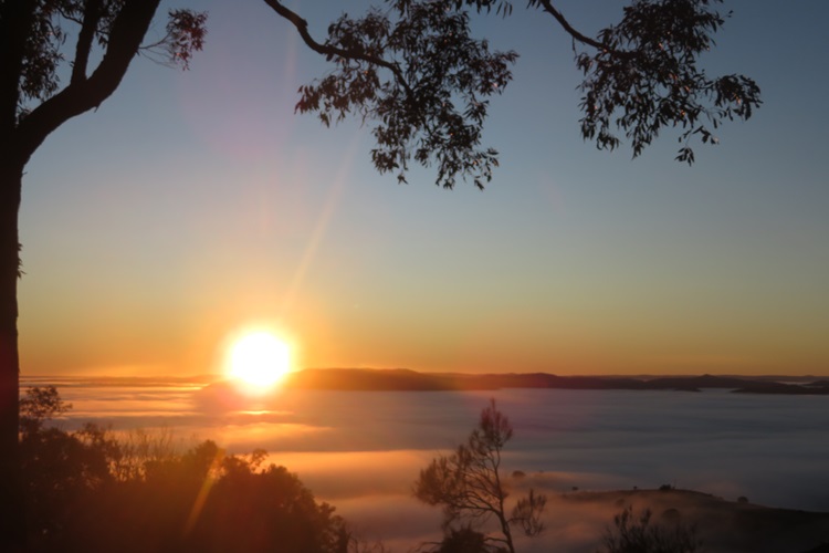
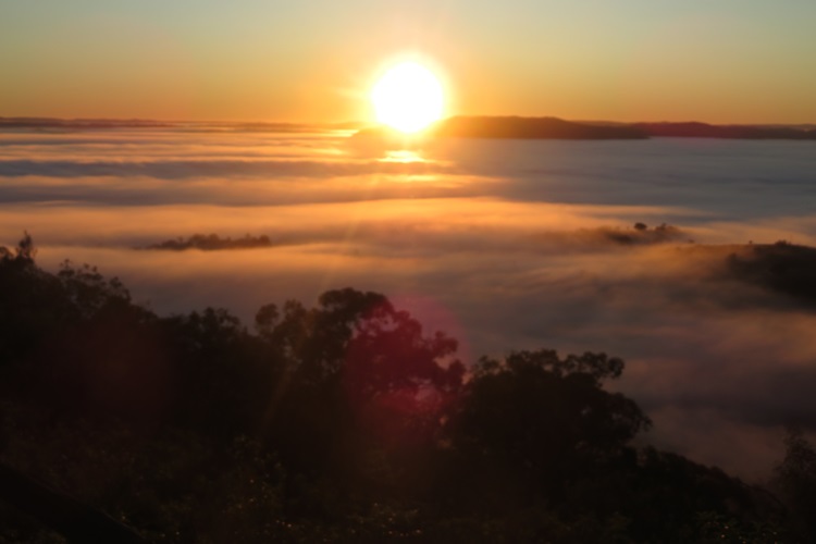
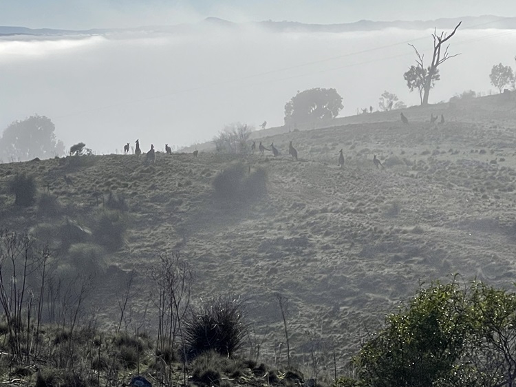
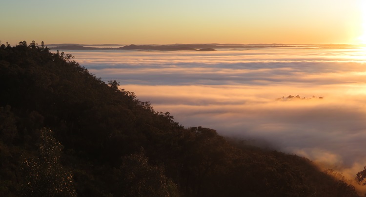
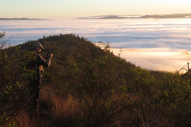
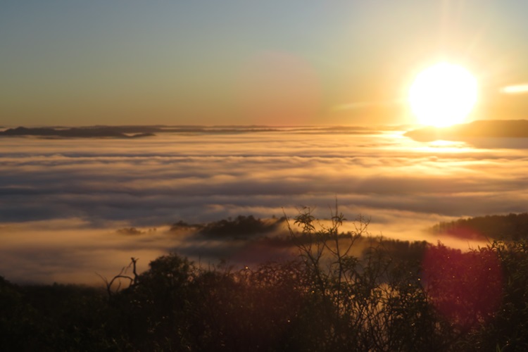
- With the fear of God in me about our upcoming Everest Base Camp adventure, I have completed this loop many times to date as part of my training. Hence, you will see some different scenery and views in my photos, all coloured by the time of day and varying weather conditions. The Husband has also contributed some lovely views via his very smart smartphone.
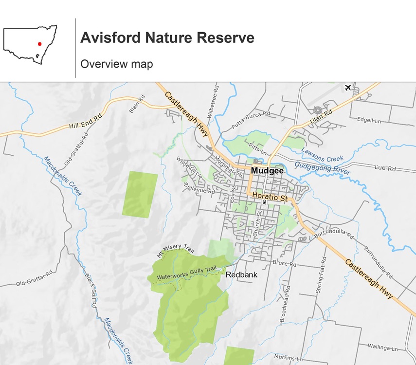
- As mentioned above, it is possible to walk this track in either direction. I usually head out anticlockwise, starting from the Mudgee Common gate.

- There is no signage/waymarking on this track. Check whether someone may have already recorded this walk in Strava or Locus. Before you set off though, have a look at the bike trail map at the Common gate and locate the “Anthill” track. That is the track you will need to follow although how they ride a bike over this terrain, I will never know.
- I understand that there are also Central Mapping Authority (CMA) maps that cover this area, although I doubt that any map would show this path. I could be wrong.
In the meantime, here are some rough directions (anticlockwise) to Mt Misery:
- Go through the Mudgee Common gate, check the map and walk up a short rise for about 30m.
- At the top of the first rise you will see a path split off to the right. Follow this path up and over another short rise (do not turn hard right) and it will bring you steeply down to a small creek that veers right.
- Follow the creek path until you see another bike trail map ahead. Walk to the sign.
- Follow the directions to get to the Anthill path and veer left.
- From that point there is no other signage with many smaller paths veering off left and right. Keep choosing the path that looks the hardest and goes straight up! 😊
- Eventually you will arrive up on a rocky ridge line (still not at the very top of the ridge) and the path disappears. Look closely and you will make out a track that wends its way between, around, and over the rocks – going up all the time.
- At the top of this rocky ridge and open saddle area, a dirt path will reappear which takes you on your final section of ascent.
- The path then levels out slightly, through open woodland and you hit the fire trail.
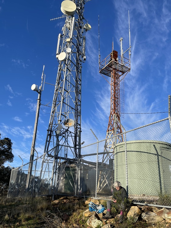
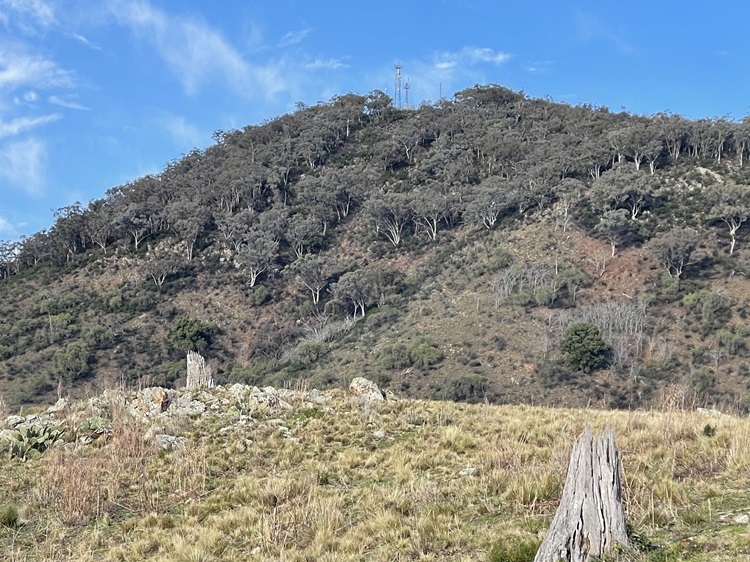
- Turn left on the fire trail and follow it up and down until you reach the Mt Misery communication towers.
- Time for a well-earned rest and enjoyment of the view.
- From the towers, turn left again and continue on the fire trail for about 150m. Turn left at the T-intersection.
- Keep following the fire trail up/down, hugging the top of the ridgeline most of the time until you start to head consistently down to another set of telecommunication towers known as Three Poles.
- From there, it is all downhill to Rifle Range Road. You will come to set of locked gates at the very bottom and there is a small gap in the fence on the left to walk through.
- Follow the dirt path for another 200m, turn left onto the asphalt Rifle Range Road, right onto Albens Lane, and left onto Kilkenny Avenue. You are back into the suburbs now.
- Turn left onto Bellevue Road and you should start to recognise where you are again. Turn a final left onto Common Road and hike back up (Yes, one final Heartbreak Hill) to the Mudgee Common.
- Phew!

Top Tips for this Track:
- To save yourself a hike back up to the Mudgee Common gate when you least feel like it, do a car shuffle and leave a car at the Rifle Range Road gate. Or leave your car parked on a wide, clear area at the corner of Bellevue and Common roads. Your legs and lungs will thank you at the end of your hike.
- Part of this trail is on mountain bike tracks. Be careful as although they are supposed to give way to pedestrians, that is not always the case.
- Be respectful on the trail. A section of the trail at the Mudgee Common end crosses private property. Do not stray from the trail and leave no trace.
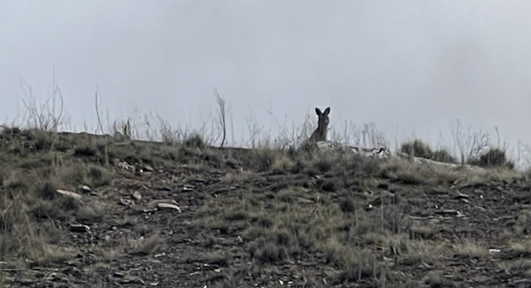
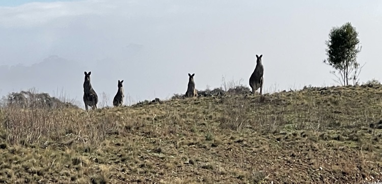
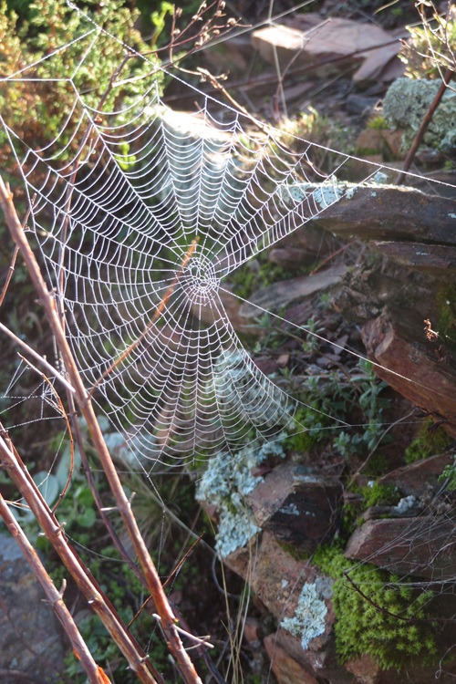
- Take your camera. The views are breathtaking and, if you tread quietly, you will see all sorts of wildlife, birdlife and native wildflowers in season.
I doff my cap to those of you who enjoy more mountainous mountains than this one, but it will do me just fine until I get to the real thing in Nepal in a couple of months time.
Happy trails to you.
Do you have a favourite training route?
The Basics
What: The Mudgee Common is only a small section of bush that joins onto the much larger Avisford Nature Reserve (2,940ha) which in turn, covers the Mt Misery area. You can check out views from Mt Misery anytime you like, and without all the effort, by viewing a camera installed by Council at the towers.
Where: The trail starts/finishes at the Mudgee Common at the end of Common Road. You can also access it from the Telstra Towers gateway about 300m along Rifle Range Road. (Yes, there is a rifle range next door, but you are perfectly safe).
When: Walking in the early morning with a head lamp is a wonderful way to greet the start of the day. Beware of hiking in the heat of the day or Summertime.
Why: For a completely different perspective of Mudgee or to work up a guilt-free appetite for later wine tasting and gourmet grazing.
How: You can drive and park at either end of the trail or it is an easy 4km walk from the centre of Mudgee. Taxis and Uber are available.
Who: This trail will appeal to nature lovers, trail runners and would-be fitness fanatics.
Related Posts: Another fantastic local walk is out the opposite side of Mudgee, along the Wollar Road to the Castle Rocks trail in the Munghorn Gap Nature Reserve. The trail is mostly clear fire trail and large pagoda rock formations are a feature.
Related Blogs: Bill uses the Mt Misery trail to train for caminos, although from personal experience, this track as NOTHING on the Pyrenees!
Read About It: For a poetic insight into early Mudgee and life in the Australian bush, have a look at the work of Henry Lawson. He was a prolific writer and poet, and really nailed the rough and tumble life of living and working in the Aussie outback.
#bushwalk #travelinspo #shortwalks #mudgee #centralwestnsw #australianflora #mtmisery #greatoutdoors #heartstarter #nationalparks #naturerserves #mudgeecommon #daywalks #hikeswithaltitude #heartstarters #visitmudgeeregion

Stunning photos Mel. Sounds like quite an adventure.
LikeLiked by 1 person
After having completed this track a number of times now, it is less of an adventure than a solid workout! 🙂 The views are stunning absolutely every time though!
LikeLiked by 1 person
You’re so inspiring, Mel. I’m pleased with myself if I walk around the streets for an hour. Gorgeous views.
LikeLiked by 1 person
More crazy than inspiring, I think! It’s amazing what you can do when you are panicking!! 🙂
LikeLiked by 1 person
gorgeous photos Mel.
LikeLiked by 1 person
Ta. Talk soon. x
LikeLike
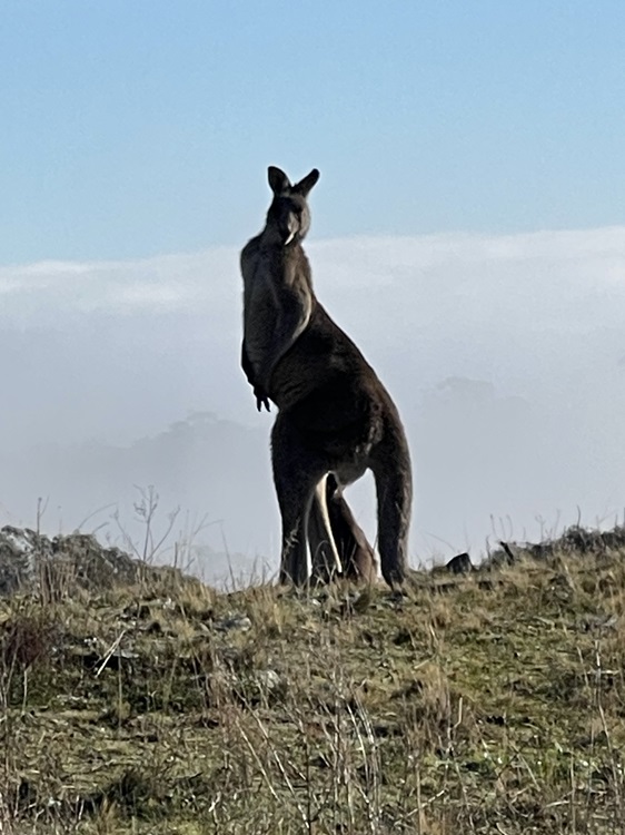
So many kangaroos! This looks and sounds like quite the lung busting way to start the day.
LikeLiked by 1 person
Yep – plenty of wildlife – roos and wild goats! Neither like our presence very much. 🙂
LikeLiked by 1 person
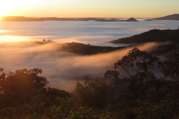
More great cloud inversion photos Mel 😀I’m sure you’ll have some short days and plenty of time to acclimatise when you get to Nepal
LikeLiked by 1 person
Thanks Jim, but I think I am stuck in panic mode! Fingers crossed I can just adapt on the trail.
LikeLiked by 1 person
Once you get there and get walking you’ll soon settle into it 😀 lovely people, lovely culture and fantastic scenery
LikeLiked by 1 person
I am looking forward to it – just pre-trip jitters. It happens every time. I did this training walk again this morning and it helps me focus on what is ahead. Have a good day, Jim
LikeLiked by 1 person
Looks beautiful Mel,, although you’re probably sick of it by now. I’m sure you’ve read all of this before but for Everest drink a LOT of water 3 L a day. And especially if you don’t eat much meat, make sure you have a lot of iron in your diet even before you go – lentils are great for this. We took some powdered Gatorade because the boiled water you will get at the tea houses doesn’t taste great and Gatorade, or other, cuts the burnt water flavour.
LikeLiked by 1 person
Great tips – Ta. I am going to make a batch of beef jerky tomorrow to top up our protein levels and am hoping to get that through customs. Also have the electrolytes in the packing pile. I feel there is so much I just don’t know, but maybe that is half the fun of travel! 🙂
LikeLike
It’s not the protein, it’s the iron that you need. As long as the iron is high in beef jerky then it’s good. 😊
LikeLiked by 1 person
Noted. Ta
LikeLike
Looks like an awesome place anyway!
LikeLiked by 1 person
It is!
LikeLiked by 1 person
No one is going to feel miserable on Mt Misery when they see such beautiful sunrises as in your photos. And, of course, you will see kangaroos. Now back to Everest Base Camp: I’m slightly nervous on your behalf Mel!
LikeLiked by 1 person
Exactly – the views make up for all the huffing and puffing although there wasn’t much of a sunrise this morning. Maybe tomorrow morning? 🙂
LikeLike
I’ll admit, that is kind of an off-putting name. Maybe it keeps people away and you have the place to yourselves? The trail itself should be called Roos & View Trail. Spectacular! I think it’s probably healthy to have the fear of God in you about this trek. Bad things probably await those who are overconfident and undertrained. With your healthy respect for the endeavor and the mountain along with your training, you’ll nail it!
LikeLiked by 1 person
Thanks for the vote of confidence! I need it! I was thinking of you this morning as I headed out on this path again. The roos were hopping along and I was thinking…’I know someone who would love to be here right now’. 🙂 Maybe not schlepping up that bloody, great hill though. 🙂
LikeLiked by 1 person
Ooh, I love that! 🦘🦘🦘
LikeLiked by 1 person
Wow your photos are stunning – that sunrise is just perfection rising above the mountain’s clouds. Mount Misery is an absolutely terrible name!!!
LikeLiked by 1 person
I have to give The Husband all the credit for the really fabulous photos. I am not an Apple fan, but Iphones take amazing photos.
LikeLike
Beautiful views.
LikeLiked by 3 people
Many thanks.
LikeLiked by 1 person
You’re welcome.
LikeLiked by 1 person
See! This is what you do best. Not lolling about on sunny beaches (I’m going backwards with your posts as I missed this one). Does husband get dragged along on these training jaunts, then? That’s true love for you.
LikeLiked by 1 person
Yep, the bush is my happy place and Yep, the husband is in training too!
LikeLiked by 1 person