I realise hiking up bloody great mountains in Nepal, or anywhere for that matter, may not be everyone’s cup of tea. There are definitely more relaxing ways to spend your time and money, and equally exotic destinations at all points of the compass.
However, if you have ever held mountains and mountain climbers in awe, and have thought ‘wouldn’t it be amazing to see Mount Everest’, then hopefully this post will take some of the mystery out of the options and planning.
Where Is It?:
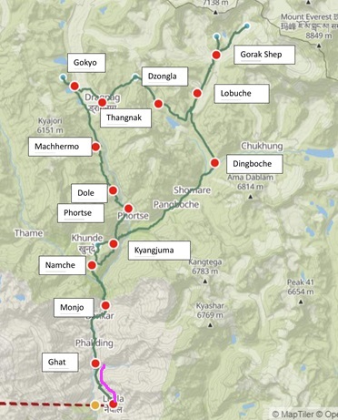
- The path to Everest Base Camp (EBC) starts from a small town called Lukla, approximately 138km due East from Nepal’s capital, Kathmandu.
- EBC is a further 65km north-east from Lukla and you have a couple of options to get there:
- Walk direct to EBC via Namche and Dingboche etc on the Everest Highway, or
- Take one of the scenic (and quieter) routes via Namche, branching out to walk on smaller paths to avoid the crowds.
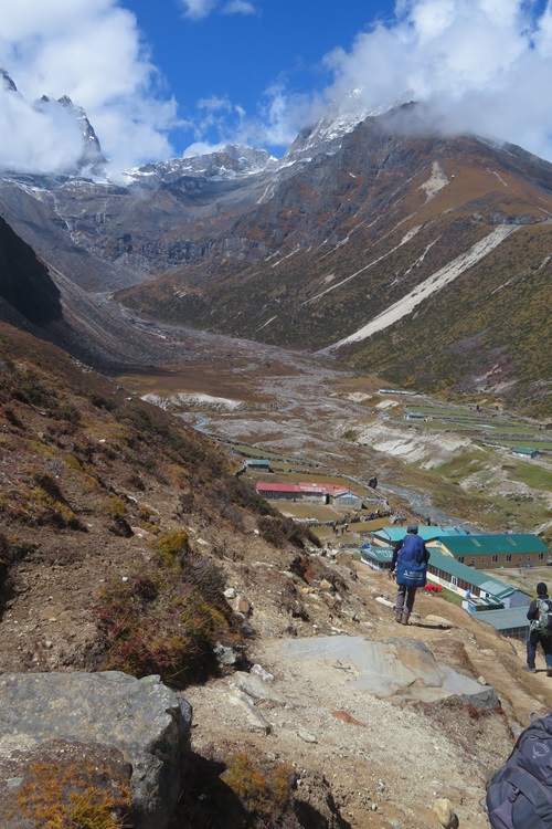
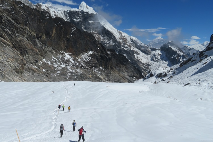
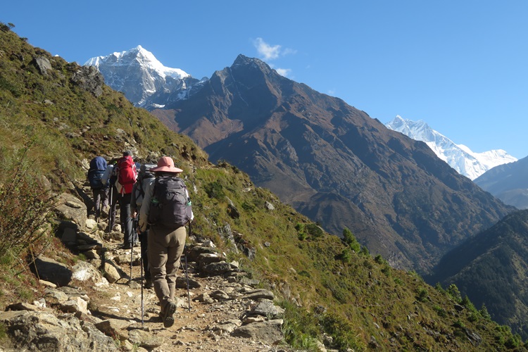
- I took the ‘left-hand’ track from Namche to Gokyo, crossing Cho La Pass (5,420m) to rejoin the Everest Highway just before the village of Lobuche.
How to Get to Lukla?:
- I won’t lie, getting to Lukla can be both problematic and highly stressful. If you have the budget, the easiest and quickest way to get to Lukla is to jump on a helicopter at Kathmandu and fly direct. It is my understanding that there are no direct plane flights between the two locations
- The second and most common option is to catch a minibus or jeep to the village of Ramechap and then a plane from there to Lukla. Please note our outward bound minibus trip from Kathmandu took 10hrs and 7.5hrs on return, and that was to cover the measly 160km one way! At Ramechap we had to wait days to get a seat on a plane. Hopefully your journey will be a lot smoother and quicker than ours.
- We did hear other horror stories of people who couldn’t get a seat on a plane taking a further nightmare 5hr jeep ride from Ramechap, then having to walk another 2.5hrs up hill to Lukla. Phew!

How to Do It?:
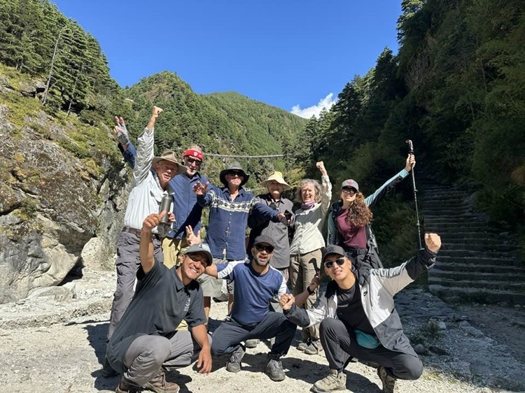
- We chose to walk supported and booked with World Expeditions. It meant we only had to walk with our day packs and the rest of our gear was transported by our awesome porters. There are many other companies who provide similar services.
- You could walk this path independently, carrying all your own gear. It is very clearly marked and it would be difficult to get lost if you stuck to the Everest Highway.
- Or, when you land at Lukla airport there are lots of enthusiastic freelance guides and porters waiting outside the airport, ready to point you in the right direction and/or carry your bag.


How Long Does it Take?:
- We all have varying fitness levels, but please don’t cut your time short on this trek.
- Allow a couple of extra days at the beginning and end of your trek to cover plane delays. We started two days behind schedule due to landslides cutting the road to Ramechap and then found a lack of plane seats due to weather closing the airports, and therefore limiting the number of planes coming in and out.
- Also, the impacts of hiking at altitude are real. You need to hike up slowly to allow your body time to adjust to the dramatically lower oxygen levels. Plan shorter days and perhaps a rest day too for acclimatisation.
- We covered the Circuit in around two weeks.


When to Go?:
- We started in early October and enjoyed the most stunning weather and crystal-clear days. It was warm-to-hot at the lower altitudes and very cold higher up, including walking through a lot of snow.
- There are definitely peak periods on the trail and we managed to avoid some of the crowds by hiking earlier in the season. It was still very busy.


What Does it Cost?:
- Going on a supported tour is naturally, much more expensive than walking independently. We chose this option because we like having a guide to share all their knowledge of the region and the fact that we just didn’t have to think about where to stay, and what to eat. The tour was pretty much all-inclusive. Also, there is no way we could have carried out own backpacks at altitude. Our tour cost around $AUD5,400pp (2023 prices) plus flights, insurance etc.
- Walking independently, you need to source everything as you go and everything becomes much more expensive the higher you walk. Rooms in lodges cost NPR500, meals from NPR800, WIFI from NPR1,000, showers ranged from NPR300-900, bottled water from NPR100-500 per litre. It’s still pretty cheap in the scheme of things, but it would add up, especially if you are paying for your guide and porter too. Do your sums.


What to Pack?: Rather than repeating it all again, check out my detailed post here.
Safety:
- Medications: You need to take all your supplies with you if you are travelling independently. Consider taking Diamox or similar to address the impacts of altitude. It certainly saved my bacon. Our guide also carried a very large and comprehensive medical kit too.
- Weather: The weather can change very quickly, including turning very cold with limited visibility in a matter of minutes. You need to carry all the right gear to protect yourself and you must know the track, and where you are heading.
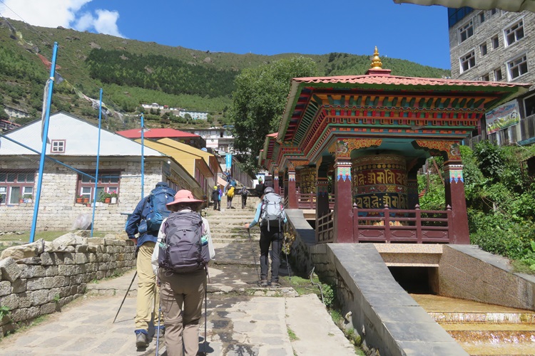
- Traffic: The track is busy with people and all sorts of yak, and mule trains. They own the path, so when they are approaching you, make sure you stand on the mountain-side of the path. One bump from them and over the edge you go.
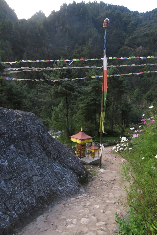
- Heights: There are many high and long suspension bridges on the early sections of this path. There are also some sections (especially on the Circuit) where the path is narrow with sheer drops to the valley hundreds of metres below. If you don’t like heights, this trek may not be for you.
- Altitude: The impacts of altitude are real. One of our group had to turn back and we spoke to other hikers who ended up in hospital in Lukla. It is a completely random thing and anyone can suffer ill effects.


Top Tips: Again, check out my detailed post here.
Who is the Hike For?:
- You need a very strong sense of adventure and a high level of mental and physical resilience. This is not an easy walk, but an amazing one.
- We saw people aged from about 6 years of age up to late 70’s. This is an equal opportunity hike if you have the determination.
- You need to be as fit as you possibly can be and used to walking up very steep ascents for many hours at a time.


What is it Like?:
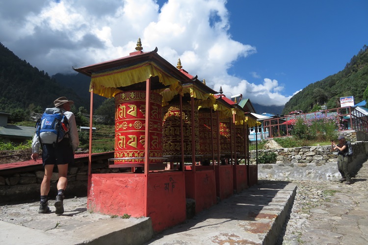
- It is busy! Even travelling early in the season, the main track (aka Everest Highway) is very popular and we would have seen hundreds and hundreds of people every day. If you are seeking solitude, then consider taking one of the quieter paths such as up over Cho La Pass.
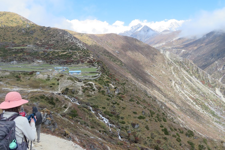
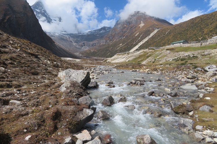
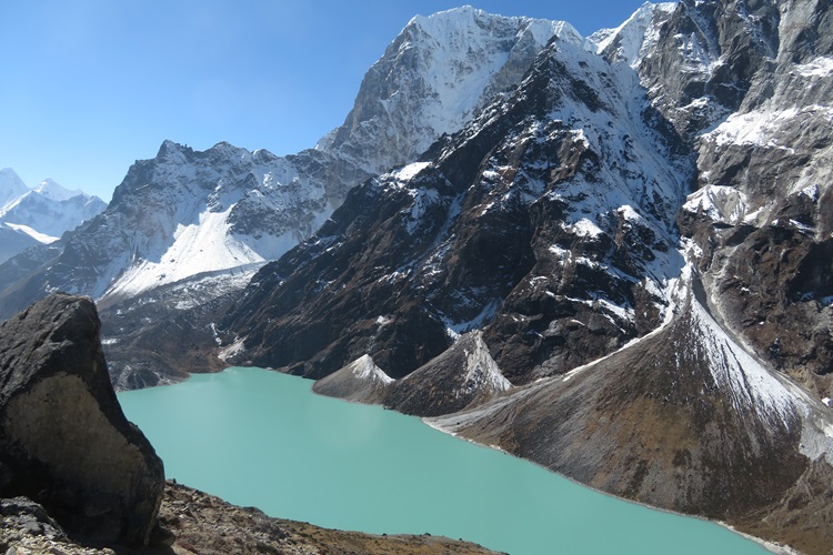
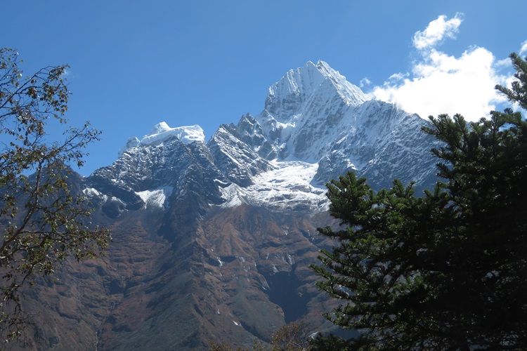
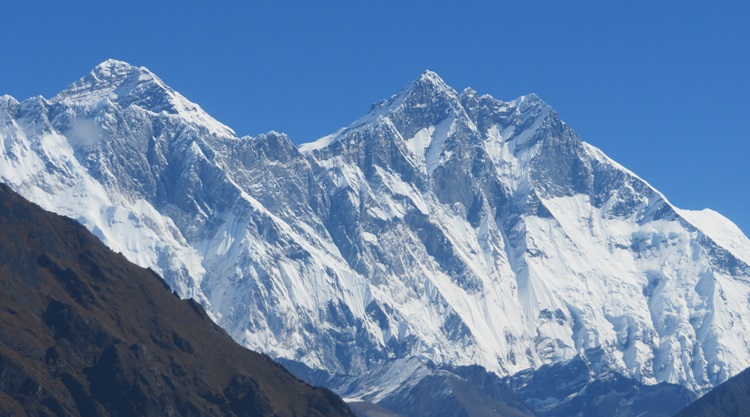
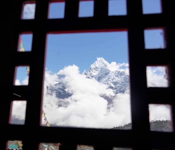
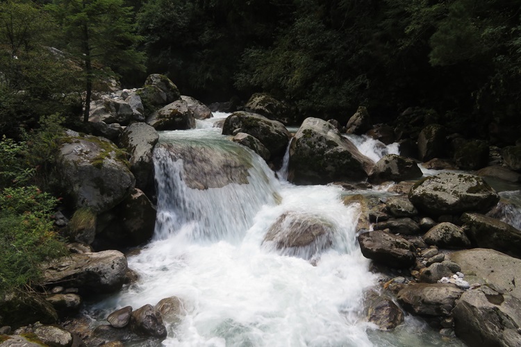
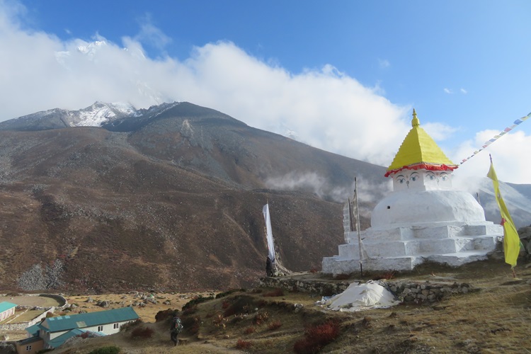
- The scenery is absolutely out of this World. At every turn are the most breathtaking views and it was hard to stop taking photos. The snow-capped mountains and snowy vistas just blew my little mind.
- This is not an easy hike and I am not sure that I enjoyed it. Every day was hard and challenged me on every level. In many ways it is as mentally challenging as physical and that is mostly due to the impacts of altitude on the body. I have never experienced what it is like walking at such low oxygen levels.
- Would I do it again? No.
- Am I glad I did it? Absolutely.
- Would I recommend it? Yes, with a whole lot of provisos.


And for a Daily Description of My Big Nepalese Adventure:
- Days 0-2 – here.
- Days 3-4 – here.
- Days 5 – here.
- Days 6 – here.
- Days 7 – here.
- Days 8 – here.
- Days 9 – here.
- Days 10 – here.
- Days 11 – here.
- Days 12 – here.
- Days 13 – here.
- Days 14 – here.
- Days 15 – here.
- Days 16 – here.
- Days 17 – here.
- Days 18 – here.
- Days 19 – here.
- Days 20 – here.
So, dear readers, this is the last of my posts about last year’s big adventure. I can hear your collective ‘Phew’ from here! I look forward to reading about all the wonderful things you have planned for 2025.
A very warm and final Namaste to you all.


#travelinspo #everestbasecamp #bucketlist #adventurebeforedementia #Nepal #Kathmandu, #Lukla #EpicAdventure #Himalayas #longdistancewalks #TheGreat Outdoors #WorldExpeditions

The adventure of a lifetime, Mel, and you lived to tell the tale AND get the stunning photos. Thanks for letting me be a part of it.
LikeLiked by 1 person
My pleasure, Jo. Wishing you more adventures ahead. X
LikeLiked by 1 person
With every post, I’m just more and more in awe of the landscape but also what you accomplished with this trip. Amazing!
LikeLiked by 1 person
It is truly awe-inspiring landscape!
LikeLiked by 1 person
A great adventure Mel, but I would do 3 Passes Trek again. Did you mean $4000 AUD not 400? Maggie
LikeLike
Oops – must be a typo. I have better check it…and Yes, your comments went into my spam! When will the system ever learn that you are a good commenter NOT Spam??? 🙂
LikeLiked by 1 person
Hi. Fine essay. Altitude sickness is a real possibility. When I was in Nepal in 1982, a guy in my small trekking group started feeling sick at around 17,00 feet, despite having hiked for two or more weeks. He wasn’t able to reach Kala Pattar, which was the highest point of the trek, and which also provided the best views.
LikeLiked by 1 person
Yep, it can strike anyone, anytime. Thankfully, not me.
LikeLiked by 1 person
Namaste Mel, and the memories will last forever 😀
LikeLiked by 1 person
They sure will and I think about this adventure every time I walk up the slightest incline! 😉
LikeLiked by 1 person
😂
LikeLiked by 1 person
Despite having read every single one of your posts on your Nepalese Adventure, each time your photos seem to be even more beautiful and breath-taking. I can’t get over the colour of the water against the snow topped mountains.
LikeLike
Yep – it is absolutely breath-taking scenery. I am so privileged to have been able to stroll through it…even if it was incredibly slowly! 🙂
LikeLike
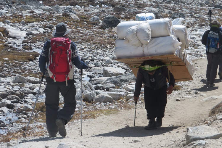
A great ending to your amazing story, Mel. I’ve enjoyed following along. I can’t imagine doing this independently. But then again, neither can I imagine doing it supported and guided! Love the picture of you “touching” the mountain (Everest summit, I presume?). And the person carrying – what, mattresses? – all hunched over like that? Ugh, his (or her) poor back!
LikeLiked by 1 person
Thanks for walking with me…even if only virtually. And Yes, those porters defied both believability and gravity! 🙂
LikeLiked by 1 person
My friend who climbed Kilimanjaro also had nothing but praise for the porters.
LikeLiked by 1 person
A tough gig, that is for sure.
LikeLiked by 1 person
It’s great to look at your beautiful photos for one last time – an adventure that will stay with you for the rest of your life! Thank you so much for sharing the joy (and also hardship) with us. I can’t wait to see what 2025 holds for you …
LikeLiked by 1 person
My 2025 adventure plans post will drop tomorrow. It’s a biggun’. 😉
LikeLiked by 1 person
Great job! It really doesn’t appeal to me but I can imagine it was an incredible experience! The photos look great.
Also, I seemingly picked up my blog-reading at the wrong end of your adventure so I’m going to have to go back and read the posts I’ve missed!
LikeLiked by 1 person
🙂 Yes, I can understand how this is not everyone’s cuppa and I would never do anything like this again, but I am so glad I did it. A momentous adventure! Have a good day and thanks for reading. Mel
LikeLiked by 1 person